No Turn On Red

No Turn On Red

Monday, June 16, 2025

Yosemite National Park - Waterfalls

Wednesday, 21 May, through Friday, 23 May 2025

As glaciers grind their way down the mountains, the scouring to make U-shaped valleys leave a lot of "hanging valleys" at the former edge of the glaciers. These laid the ground (literally) for the spectacular waterfalls that cascade over the sheer cliffs of Yosemite. Meltwater from winter snows typically peaks in May, so we got to see the falls at their best.

Bridalveil Fall

Bridalveil Fall is the first prominent waterfall seen when entering Yosemite Valley.


Yosemite Falls

Yosemite Falls is farther up the valley and is visible from many locations. It has two main falls (upper and lower) with a cascade in between


A short trail leads up to the base of the lower fall. On a warm day, the mist is refreshing.

Upper fall.

Yosemite Falls as seen from Glacier Point.

Ribbon Fall


Horsetail Fall

Horsetail Fall, like many of the smaller waterfalls can be difficult to see at first. In the photo above, it's a white patch in the center of the photo, totally dwarfed by the mountains and landscape.

The waterfall is easier to see from other vantage points.

As seen with a telephoto lens (or binoculars).

Nevada and Vernal Falls

Nevada Fall (top) and Vernal Fall (bottom) as seen from Glacier Point.

The best view of these falls is from Washburn Point.

Vernal Fall

Nevada Fall

We think that this is brief glimpse of Nevada Fall from Happy Isles Road.

Sentinel Fall

Sentinel Fall


Yosemite National Park - Overview

Wednesday, 21 May, through Friday, 23 May 2025

Yosemite is a land of both the vertical and the horizontal. A classic U-shaped valley formed by glaciers, the valley abounds with dramatic views, sheer vertical cliffs, and (in season) a spectacular collection of waterfalls. We spent 2 1/2 days in the valley - the road to the higher elevations of the park was still closed for the season.

Entering Yosemite from the south, you are met with a stunning view of Yosemite Valley as you exit the Wawona Tunnel. (We entered Yosemite from the west (El Portal), which gives great views, but they are not as spectacular as "Tunnel View".)

A closer view of Yosemite Valley from El Capitan (left) and Cathedral Rocks (right) to Half Dome in the distance.

At valley level and further down the valley. El Capitan at left, and Bridalveil Falls at right.

Half-dome and the Yosemite Valley.

Mirror Lake is a short hike from Curry Village.

Vintage photo from 1988. I hadn't remembered going to Mirror Lake, but we did. Christy was 2 years old and pretty much stayed in the backpack. David was 4 months shy of 4 years old.

Mirror Lake

Mirror Lake

The trail continues beyond Mirror Lake to footbridge over Tanaya Creek.

The Merced River near Happy Isles.


The creeks leading from the waterfalls have a special, mystical quality. Above: mist at the base of Yosemite Falls.

Sunlight and mist at the base of Bridalveil Fall.

Glacier Point Road had been recently opened for the season. It leads to two overlook areas: Washburn Point and Glacier Point.

Panoramic view from Washburn Point.

Half Dome as seen from Washburn Point.

Panoramic view from the first overlook at Glacier Point.

Half Dome still dominates the view.

Panoramic view from the second overlook at Glacier Point.

Tenaya Creek Canyon lies between Half Dome and North Dome. Curry Village is at the bottom of the photo. Mirror Lake is the open area in the midst of all that green at the base of Half Dome.

Royal Arches at the base of North Dome.


Saturday, June 14, 2025

California Coast & Napa Valley

Sunday, 18 May 2025

The Pacific Coast Highway was (and still is) closed south of Big Sur, but we still got to see some of the coast around Santa Barbara. We headed inland and had lunch and a wine tasting in Paso Robles before getting to our overnight stop in Santa Cruz.

The hills/mountains along California Highway 1 were filled with neon-yellow flowers.


Monday, 19 May 2025

In addition to walking across the Golden Gate Bridge, we drove along the coast from Santa Cruz through San Francisco, then drove a bit further north. We turned inland to see redwoods, and spent the night near Santa Rosa.

Waddell Beach

Pigeon Point Lighthouse

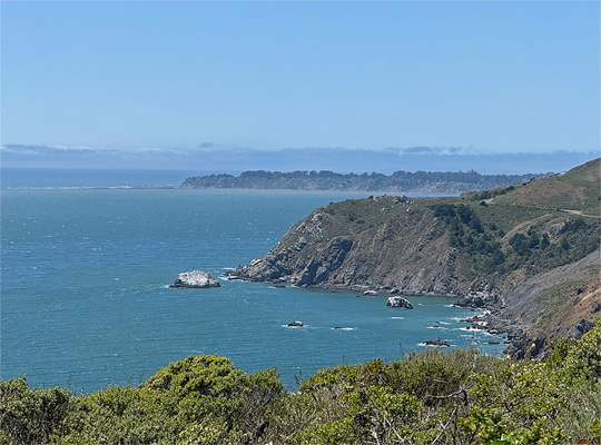
View from Tick Point

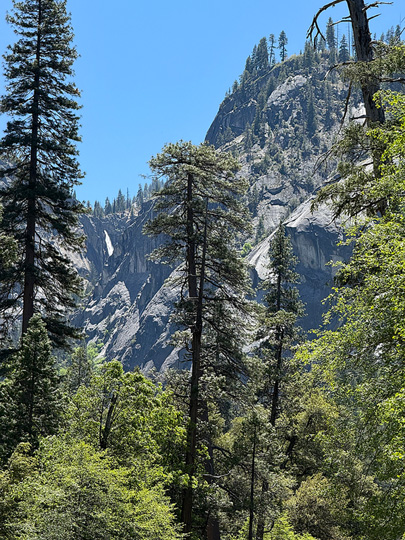
We didn't realize until it was too late that Muir Wood requires an online purchase of a parking pass. So we visited Armstrong Redwoods State Natural Preserve instead.

Rootball from fallen redwood at Armstrong Redwoods.


Tuesday, 20 May 2025

We visited two wineries in the Napa Valley - Trefethen and Grgich Hills. Both were excellent tasting experiences. The weather was California-perfect. We had an excellent lunch at Mustard's Grill - who knew reservations were recommended (but not essential) for a weekday in mid-May?

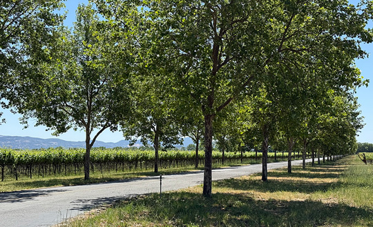
The road into Trefethen Family Vineyards.


The tasting room at Trefethen Family Vineyards.


A Walk Across the Golden Gate Bridge

Monday, 19 May 2025

It is possible to walk across the Golden Gate Bridge. The best starting point is the Vista Point parking lot on the north end of the bridge, accessible only from the north-bound lanes of US-101. Round-trip distance is about 3 1/2 miles - about a 2 hour walk if you stop to enjoy the view and take photos. There is no shade, usually quite breezy, and the noise from six lanes of traffic is considerable. We should have brought ear plugs.

The view from Vista Point - from far left: Alcatraz, San Francisco-Oakland Bay Bridge, downtown San Francisco, Golden Gate Bridge.

Golden Gate Bridge as seen from Vista Point.

Sue at the northern tower, looking south.

View from bridge: Alcatraz, Bay Bridge, San Francisco.

Alcatraz

Golden Gate Bridge as seen from the southern end.

Looking north from the middle of the bridge. Pedestrians share the sidewalk with 2-way bicycle traffic. 

Friday, June 13, 2025

Pinnacles National Park

Sunday, 18 May 2025

Pinnacles National Park is a small national park in the Pacific Coast Ranges of central California. Originally set aside as a national monument to preserve the unique geology, it became a national park in 2013. Today it is mostly known as the location for release of California condors raised in captivity. The park has an east and a west entrance, but no road between the two. Today we visited the west side of the park in the hopes of glimpsing a condor. We had previously visited the east side in 2018.

The "Pinnacles" are eroded remains of ancient volcanic activity. The San Andreas Fault lies just off the east side of the park.


Unsurprisingly, we did not see condors, but we did see quite a few turkey vultures.