No Turn On Red

No Turn On Red

Tuesday, September 26, 2017

Hawaii - Part 1 - In the Air

Thursday, 14 September 2017

We started our trip to Hawaii with a long day of flights from Roanoke to Washington-Dulles to San Francisco to Honolulu. When I have a window seat, I can’t refrain from taking way too many pictures. Usually they are more interesting in the live moment than as photos, but flying over the western U.S. showed many fascinating sights - both natural and man-made. It was also interesting to see from above much of the same territory we drove through two weeks earlier.

Irrigated fields in western Kansas or eastern Colorado. (It’s difficult to place from the air!)
Fall colors in western Colorado.
Black Canyon of the Gunnison.
Texas Gulf Potash near Canyonlands National Park, Utah.
Looking into Canyonlands National Park. The Texas Gulf Potash facility can be seen in the lower right.
Green River north of Canyonlands National Park.
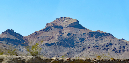
Basin-and-range geography in Nevada.
The Crescent Dunes Solar Energy Project near Tonopah, Nevada.
Chemetall Foote Corporation near Silver Peak, Nevada.
Nevada-California. That might be Mt Whitney in the background.
The Sierra Nevada. Yosemite National Park is probably in there somewhere.
I think this is the (in?)famous Hetch Hetchy Reservoir -- the major source of water for San Francisco and the site of one of the first environmental battles over water and preservation.
I have no idea what makes these bright primary-colored fields/ponds at the far south end of San Francisco Bay.
Mystery solved with the help of Atlas Obscura -- salt ponds. Read the full story on Atlas Obscura.
Directly across the bay are these lightly-hued field/ponds.
The highly artificial-looking Foster City on San Francisco Bay.
About 2300 miles from San Francisco, the first signs of the Hawaiian Islands are the clouds hanging over them.
The Disney Resort on the west side of Oahu.


Tuesday, September 5, 2017

Trails & Trees - Part 26 - Heading Home

Wednesday, 30 August 2017

Nevada - Utah - Colorado

The trails and trees are behind us now. It’s I-70 to I-64 to home. But there’s still some spectacular scenery here.

As we left Great Basin National Park, we could see past the mountains to the next basin.
A better look at the basin plains.
The left mountain in the first photo is clearly made up of different rocks than the rest of the park along Wheeler Peak Scenic Drive.
In Utah, we passed along the shore of Sevier Lake, which looked more like a salt flat than a lake.
Eroded rocks along I-70 in Utah.
Utah has a number of scenic pull-outs along I-70. This is a panorama from Sand Bench View.
Sand Bench View
Spotted Wolf Canyon View panorama.
I-70 goes through Spotted Wolf Canyon. Before the road came through, this canyon was so narrow that a person could touch both sides simultaneously with outstretched arms.
The sun was setting as we made it to Colorado, so we went through the Rockies in the dark.


Trails & Trees - Part 25 - Great Basin National Park

Wednesday, 30 August 2017

More trees: The star attraction of Great Basin National Park in Nevada are the bristlecone pines -- the oldest living organisms on earth.

To get to the most easily accessible grove of bristlecone pines, you have to take a short (1.5 mile, 600 ft climb) hike from the Bristlecone-Alpine Lakes trailhead.
The trail is mostly rocks and affords spectacular views.
Bristlecone pines along the trail.
This bristlecone pine is dead, but most are still alive and are 3000 to 4000+ years old.
Some people think bristlecone pines are grotesque and belong in a Dr Seuss book, ...
... but I think they are fascinatingly beautiful.
Left: A close-up of a branch shows why the trees are sometimes called “bottlebrush” pines.
Center: An immature cone shows the namesake bristles.
Right: Sap oozing over a mature cone
The Visitor Center in Baker, NV, has a “tree cookie” from “Prometheus”, a bristlecone pine that was cut down in the early 1960s (details are contested) that was later determined to be about 5000 years old, and the oldest (formerly) living organism on earth.


Trails & Trees - Part 24 - On the Road

Tuesday, 29 August 2017

“As the crow flies” it’s not that far between Kings Canyon National Park and Death Valley National Park, but there are very limited routes across the Sierras. We had to drive all the way down to Bakersfield to get over the mountains. It also didn’t help that we needed to take time out in Bakersfield to get an oil change for the truck and pick up supplies.

The first part of our drive was on small twisty backroads through the Sierra foothills.
The grass was quite tall and very dry. The low sun angle highlighted all the ridges.
I finally got to see Joshua trees.
Just one more ridge away from Death Valley.
Corkscrew Peak on the east side of Death Valley. It was a hot day -- our car thermometer peaked at 123°F (51°C) at Stovepipe Wells.
We never encountered any rain, but we did see a partial rainbow while driving across Nevada.
 Nearing sunset. We got to Ely, Nevada rather late and splurged on a motel for the night.


Trails & Trees - Part 23 - Sequoia and Kings Canyon National Park

Monday, 28 August 2017

After viewing so many trees, it was time for hiking!

The view from Beetle Rock near the Giant Forest Museum in Sequoia National Park.

For the last activity of the day, we hiked up to the top of Big Baldy in Kings Canyon National Park -- a distance of about 2.5 miles each way, and a 600 ft climb. With the ups-and-downs of the trail, it was probably closer to 1000 ft of total uphill work. (And the downhill route required about 300 ft of climbing.)

The objective of our hike -- the top of Big Baldy offers 360° views.
The views kept on getting better as we went up the trail. The summit of Big Baldy is on the left.
We made it!
The view was amazing, but dizzying.
I didn’t want to get too close to the edge!
Lon at the top.
On the way back down.
Some of the granite rocks were blood-red. They really stood out among the dusty yellows and grays.