No Turn On Red

No Turn On Red

Saturday, October 31, 2020

GAP - C&O Canal - Day 9

 Tuesday, 20 October 2020

White's Ferry (Leesburg) to Washington (Georgetown), 32 miles

The last day of the ride had some spectacular sights: wildlife, Great Falls, beautiful vistas.

Resurfacing was underway from milepost 25 to milepost 23. We had to ride around piles of "crush and run" and small heavy equipment. And we mentioned to each worker how much we appreciated their work on the trail!

Resurfacing the towpath.

The Seneca Creek Aqueduct is the only one made from red stone -- the same stone that was used to make the Smithsonian "castle" on the mall in Washington. The upstream arch was destroyed in a flood in 1971 and has been replaced with a bridge.

Sue at Lock 22.

It was a good day for wildlife. Here a great blue heron was searching for fish from rocks in the Potomac.

We finally had a day that was warm enough for turtles to emerge from the canal to get some sunny warmth on a log.

A "small" flume separating Olmstead Island (left) from the river bank (right). Olmsted Island is really just an impenetrable set of boulders in the middle of the Potomac. A boardwalk crosses Olmsted Island for a view of the main channel. 

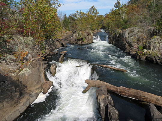
The main channel at Great Falls.

A panorama of Great Falls. The river drops over 70 ft in less than a mile with numerous 20-ft drops.

The overlook on the Maryland side (where the previous two pictures were taken).

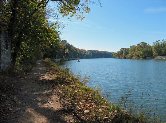
"Widewater". Below Great Falls the canal enters a wide channel that was formerly part of the river. It is protected from the current Potomac River by a guard wall. Mother Nature doesn't always respect man's intentions and floods have been known to top the guard wall and flood this section.

Milepost 0 is in a well-hidden location where Rock Creek enters the Potomac. If you don't have a map, it would be nearly impossible to find -- you have to go through Thompson's Boat Center to get there, and this definitely feels like you are trespassing on private property.

We haven't gotten any better at selfies.

Washington panorama from the Key Bridge. After completing our ride, we had to cross the Potomac to pick up a rental minivan in Rosslyn to drive back to Pittsburgh and retrieve our truck.

Friday, October 30, 2020

GAP - C&O Canal - Day 8

Monday, 19 October 2020 

Harpers Ferry to White's Ferry (Leesburg), 26 miles

This was our shortest day of our trip, only 26 miles -- and entirely resurfaced in the last two years. What a treat! By the end of the day, we've ridden bikes through two states (Pennsylvania and Maryland), but spent the night in four states (adding West Virginia and Virginia).

Harpers Ferry: A final view of the bridge over the Potomac.

Lon walking his bike across the pedestrian bridge. Even on Monday morning, there were quite a few tourists in Harpers Ferry.

An osprey nest on the bridge. Ospreys will put a nest on any high flat surface that is near water.

Pushing my bike up a steep bank after cross a small creek on a footbridge. After taking a tumble yesterday while trying to ride across a similar footbridge, I walked over all remaining small bridges.

Catoctin Creek Aqueduct

Catoctin Creek

Sue on the Monocacy Aqueduct.

The Monocacy Aqueduct is the longest aqueduct on the canal, with seven arches spanning a total of 516 ft.

Canal and towpath (Potomac off to the right). Sometimes the canal water is reasonably clear (foreground), and sometimes it's covered in algae and other vegetation (background).

Someone had added Jack O Lanterns to the wall of Lock 26. Lon joined them.

Our night's lodging was on the outskirts of Leesburg, VA, so we crossed the Potomac on the "Historic" White's Ferry (toll $2 for bicycles). White's Ferry is the last operating cable ferry on the Potomac, and the only way for vehicles to cross the Potomac between US-15 at Point of Rocks and I-495 just outside Washington. We got a shuttle ride to the hotel.

Thursday, October 29, 2020

GAP - C&O Canal - Day 7

 Sunday, 18 October 2020

Williamsport to Harpers Ferry, 40 miles

It's Sunday, so we shared the great scenery and historical sites with a lot of people. Harpers Ferry was particularly crowded.

Lon bikes along the "Big Slackwater" section of the towpath. In this 2 1/2 mile stretch above Dam 4, the canal disappears and the canal boats/barges used the river. As you can see, it was difficult just to make room for a towpath, much less a canal, too, between the river and the rock bluffs.

The Big Slackwater section of the towpath was opened in 2012 after a $19 million restoration project.

McMahon's Mill

Dam 4

Sue at Dam 4.

The guard gate at Dam 4 protected the downstream canal from flooding.

Towpath. The depression at left is the remains of the canal. The Potomac is off to the right.

In several sections the Potomac was filled with large boulders -- similar to the James River at Richmond.

North bank (Maryland side) of the Potomac at Harpers Ferry: Lock 33, "Maryland Heights" cliffs, and two railroad bridges crossing the Potomac. Just below the railroad bridge, the Shenandoah River enters the Potomac.

Two railroads emerge from a tunnel in Maryland, and then immediately cross the Potomac into Harpers Ferry, WV. The bridge on the right has one of the two tracks turned into a footpath across the Potomac. This is also the route for the Appalachian Trail. Harpers Ferry was crowded shoulder-to-shoulder with tourists.

To get to the footpath over the Potomac, you had to climb up about 25 feet on a busy, spiraling staircase.

High Street in Harpers Ferry. Despite how it looks, this is a steep street!

Wednesday, October 28, 2020

GAP - C&O Canal - Day 6

 Saturday, 17 October 2020

Little Orleans to Williamsport, 42 miles

The Western Maryland Railroad Trail closely parallels the C&O Canal and towpath for almost 30 miles between Little Orleans and Fort Frederick State Park. We chose to ride the paved asphalt rather than the towpath in this section. We missed a few sights along the river by doing this, but we also got great views of aqueducts from the WMRT.

A beautiful, but cold, sunrise at the Town Hill Overlook. The Inn provided an unforgettable gourmet breakfast.

We hadn't gone very far when we realized that Lon's front rack was no longer attached to his front fork on the right side. Duct tape works wonders -- and held until we got back home.

The Western Maryland Railroad Trail is paved and usually about 20 feet above the canal and towpath.

Sideling Hill Creek Aqueduct

Licking Creek Aqueduct. In this area, I-70 parallels the WMRT for about 5 miles. In this stretch the (former) canal, (former) railroad, and the (modern) Interstate closely follow the north side of the Potomac, illustrating the change in transportation over the last 200 years.

Fort Frederick State Park. Fort Frederick was built for the French and Indian Wars in 1756, and was crucial for protecting the canal in the Civil War.

Restored barracks inside the fort. Visitors can only stand at the main gate to look into the fort.

Dam 5. For a half-mile above the dam, canal traffic used the river rather than a canal. This was known as "Little Slackwater".

Sue and the view downstream of Dam 5.

Just above Williamsport is the Conococheague Creek Aqueduct.

Lon on the Conococheague Creek Aqueduct.

The Conococheague Aqueduct has been recently restored, and is the only aqueduct that currently holds water.


GAP - C&O Canal - Day 5

 Friday, 16 October 2020

Cumberland to Little Orleans, 44 miles

Today was forecast to be cold and rainy. We got lucky. Cool it definitely was (50°s), but the rain was very light -- mostly drizzle and mist. This was our first day on the canal towpath, and we were introduced to locks, aqueducts, and the one tunnel on the path.

75 locks raise the canal a total of 600 ft. That makes each lock an 8-ft rise. Each lock, or set of locks, has a lock house to house the workers that operated the locks. Sometimes there was just a stone foundation remaining. Closer to Washington, a few of the lock houses are available for overnight stays - bring your own bedding, food, and cooking equipment.

Typical canal scenery. Canal on the left (here with water in it, many times it was swampy or filled-in), towpath in the middle, Potomac River on the right.

Another towpath scene. This time the canal is merely a depression running along the towpath. It's interesting to note that all the trees between the canal and the towpath must be less than 100 years old - the canal was in use until 1924, when yet another flood was the final straw that forced it to be abandoned.

Who knew that a canal could go through a tunnel? This is the 3118 ft long Paw Paw Tunnel that bypasses 5 miles of river bends. The towpath is a narrow ledge alongside the canal. Fortunately, today it has a fence for safety.

Inside the Paw Paw Tunnel. It's lined with 6 million bricks!

One of several surveying benchmarks in the tunnel wall. Light provided by Lon's phone.

The eastern end of the tunnel.

After exiting the tunnel, the path continues through an open rock cut on a cantilevered boardwalk.

At the end of the boardwalk, part of the facing rock wall has collapsed into the canal.

The path through the rock cut is quite narrow.

In addition to the tunnel, the canal traverses several aqueducts. The upper end of the path has smaller aqueducts, such as this one over Fifteenmile Creek. In the lower part of the path, approaching Washington, the aqueducts are longer and go over full-sized rivers.

The view from Town Hill Overlook "near" Little Orleans, Maryland. This was across the road from our night's B&B (the Town Hill Inn), which was a 7-mile shuttle ride from the towpath. (And serves a spectacular breakfast - truly "the best breakfast on the trail".)